BGS mineralogy and petrology collection record
| Sample number | S46784; COLLNOXP585; |
|---|---|
| Sample Donor | Read,W.A. |
| Rock name | Not entered |
| Stratigraphy | Not entered |
| Comments | Typical of the 200 ft+ thick Dun intrusion. ?A thickened Downie's Loup sill |
| Locality details | Waterfall 500 ft NW of summit of The Dun, 2650 ft at 112 deg from Culcreuch House |
| 50k map sheet | Stirling (39) |
| Map reference | NS 6278 8737 |
| Year collected | Not entered |
| Bore name | Not applicable |
| Confidentiality | No restrictions |
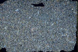
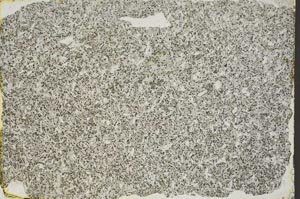
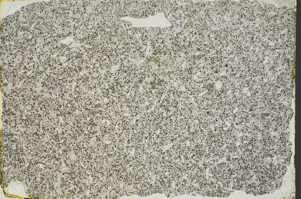
Petrological thin sections
Links to high resolution images
Transition from XPL to PPL light
S46784